Understanding Soils With the Help of Sensors
Noble researchers are using sensors to gain a better understanding of the effects of tillage and cover crops on soil moisture, temperature, erosion and organic carbon.
Sensors are being used more in our everyday lives. Simply put, they are devices that measure or detect a change in our surrounding environment and provide feedback. The feedback provided then needs to be interpreted into useable information that can then be used for decision-making or to increase our understanding of how something, like a biological system, functions.
Sensor use has really taken off in the automotive industry and is helping drivers improve safety. Sensors can detect approaching vehicles and apply brakes or warn drivers of oncoming traffic when crossing a roadway. Anti-lock brake systems use sensors to detect changes in wheel rotation then correct braking pressure to avoid skidding. All of these automotive applications lead to better driving decision-making and improved driving safety.
In agriculture, we are still discovering new ways to apply sensor technology, and the sky appears to be the limit for future applications. Just as in the automotive industry, the data collected by sensors has to be interpreted into useable information that a producer can use to make a better management decision than they can currently.
Sensors Help Consultants Make Better Recommendations
Opportunities for sensor use in research appear to be just as boundless, but our objectives in the use of sensors is somewhat different. Research applications of sensors aid understanding of how a biological system works or gain a deeper understanding of treatment effects, and increase the resolution of data collection. All of this eventually leads to improved management recommendations for producers.

Detecting Soil Moisture and Temperature
In applied research, we are using soil moisture sensors to increase our understanding of water use by summer cover crops in winter pasture forage systems as well as the effects of till or no-till within these systems. To do this, we are deploying soil moisture sensors at depths of 3 inches, 10 inches and 24 inches in each treatment replication.
In addition to detecting soil moisture, these sensors are also equipped with temperature sensors that provide us with soil temperature readings. Soil temperature is important for at least two reasons:
- The warmer or hotter the soil gets, the more water is moving out of the soil due to evapotranspiration.
- The effect of temperature on soil microbial activity as microbial growth will decrease when temperatures move past 85 degrees Fahrenheit.
Each sensor location has a data logger that collects readings once every hour then transmits that data to a central location via a radio signal. Readings are transferred to a computer with a software package that transcribes the raw data into useable information.
From the data gathered by the soil moisture sensors (Figure 1), we can see that tillage summer fallow soils tend to have the lowest soil moisture content compared to other soils while no-till summer fallow soils have the highest.
Something that is interesting to note is that the tillage cover crop treatment tend to have higher soil moisture than tillage summer fallow especially at lower depths. This is probably due to the cover crops shading and cooling soil temperatures, aiding the retention of soil moisture. The cover crops are using soil moisture for growth but not to the extent that tillage summer fallow soils are losing soil moisture due to evapotranspiration. Soil temperatures in the tillage summer fallow treatments have risen past 110 degrees Fahrenheit during the peak of summer, which suppresses soil microbial activity.
Determining Soil Loss
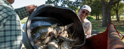
Another sensor technology that we are employing with this study is the use of drones. We fly drones over the study area, which is 100 acres in size, to assess treatment effects on crop emergence and, most recently, to help us determine soil loss due to water erosion.
To determine soil loss, we fly the drone equipped with Lidar (light detection and ranging) cameras to measure the dimensions of eroded areas. Then, we calculate the volume of soil it would take to fill the eroded areas back up level with the surrounding field. In one of our tillage summer fallow treatment paddocks, we have an estimated soil loss of 8 tons. Take a moment to consider the ramifications of this on soil health. If this field is tilled and the eroded area is filled back up with tilled soil, we would lose another 8 tons of soil in the next big rain event.
Measuring Soil Organic Carbon
One last example of our current sensor technology research involves our desire to quantify soil organic carbon and its response to management. The potential for soil organic carbon sequestration in agricultural production systems has been well reported; however, the logistical mechanisms of dealing with spatial soil variability has posed problems for accurate quantification. Along with variability concerns, the cost of sampling fields for laboratory analysis with a level of moderate to high density can be prohibitive.
A method currently used to mitigate cost concerns is the use of spectroscopy, specifically, visible, near and mid-infrared spectroscopy. The prediction of various soil properties including soil moisture, soil organic carbon and total soil nitrogen content have been developed using near-infrared (NIR) spectroscopy techniques as a useful quantitative tool.
Spectroscopy using laboratory-based instrumentation has been used to predict soil carbon levels, but field conditions limit the accuracy of these estimates. The combination of geospatial data products along with visible/near-infrared (VNIR) spectroscopy measurements of soils to model soil carbon content may provide a solution.
VNIR spectroscopy has been reported as an effective method of detecting changes in soil carbon content based on their soil spectral reflectance. We are currently working with Yale University to test hand-held spectrometers, which is yielding positive early results. This approach provides considerable opportunity for providing decision-support information for agricultural producers at a reduced price point over conventional testing. It also offers a better way to understand viability across soil texture classes and soil depths as soil carbon concentration changes.
The use of sensor technologies is helping research understand the functioning of biological system and build a strong case for conversion to no-tillage practices.
James Rogers, Ph.D.
James Rogers, Ph.D., former Noble Associate Professor
Jeff Goodwin
Jeff Goodwin, program director at Texas A&M’s Natural Resources Institute
Comment