Drones on the Farm
Unmanned aerial vehicles and the sensors associated with them have potential as a tool for farmers and ranchers. We're testing them out.
There’s plenty of buzz about drones and sensors in agriculture today. Farmers and ranchers hear about the technology but may have questions about if they should adopt it or how, especially considering how many companies and products are out there.
At the Noble Research Institute, we’re working to incorporate drones and sensors into our research and farming/ranching operations so we can better understand the potential of some of these devices.
What are drones and drone-based sensors?
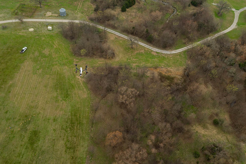
Drones, more formally known as unmanned aerial vehicles (UAVs), are flying machines that someone on the ground can use to collect images from the air. These images range from simple – similar to those you could take from an airplane – to extremely complex and data-rich. These complex images are generally gained through the use of sensors that are attached to the UAVs. Different sensors can capture various information, such as forage quality and rainfall amounts.
Why would a farmer or rancher want to use this technology?
There are many potential applications of drone technology. Simple UAV cameras could help a producer locate and count equipment, animals, or hay bales. They could assist in controlling prescribed burns, checking fences and water sources, inspecting fields, or identifying trees (like pecan) from other vegetation. More complex sensors could allow producers to estimate the amount of water in a pond and estimate the quantity and quality of forage plants available for grazing livestock.
How are drones and drone-based sensors used at the Noble Research Institute?
We started using drones in 2014 as part of our cotton root rot research. The large-scale images and data we were able to collect allowed researchers, like Carolyn Young, Ph.D., and Chakradhar Mattupalli, Ph.D., of the Noble Research Institute’s mycology lab, to better study the spread of cotton root rot disease in alfalfa fields.
We also measure plant health using sensors that measure the normalized difference vegetation index (NDVI). One device we’ve been pleased with for this purpose is Sentera’s Standard NDVI Single Sensor. This sensor is small in size and relatively inexpensive compared to other sensors used for similar measurements. We’ve successfully used this sensor to identify bare ground in pasture and range, monitor plant growth in alfalfa trials, and identify areas of cotton root rot. As you can see, the applications of this technology are broad and can impact research across many disciplines within agriculture at the Noble Research Institute.
What is the state of this technology today and potential for the future?
Interest is growing and there are producers using this technology, but it is not commonly used right now. It can be expensive to buy a drone and the additional sensors, and there are other fees associated with storing data. Anyone who flies a drone for business purposes must be certified with the Federal Aviation Administration (FAA) as a remote pilot and must comply with restrictions on when, where and how the drone is operated.
As with any decision, producers must decide if the benefits outweigh the costs before they choose to adopt the technology. Overall though, the future of drone-based sensors in agriculture is promising as data can be integrated into precision agricultural equipment more easily with clear expectations for increased return on investment.

Mike Komp
Mike Komp, former Noble Technical Program Manager, Ag Technology
Comment